Picture from Mysteries of Egypt
Geography
How did the geography of Ancient Egypt influence life in the region?
An important feature of geography is the Nile river. In 5000 B.C, hunters and gatherers began to move toward the Nile's fertile land. They began to farm and build villages along the "black land". Egyptians gathered papyrus, a reed plant that grows along the Nile river. The Egyptians used the long thin reeds to weave rope, sandals, baskets, and river rafts. One very important item that they made later on was paper, made from papyrus. Farmers grew their crops around mid-October to mid-February and harvested around mid-February to mid-June. For the rest of the year the farmers did not harvest or plant because that was when the Nile flooded. When the Nile flooded it deposited silt which made the land fertile. The "red land" was the desert that made it hard for any enemies to come near. If the invaders made it through the desert, the Nile river also had dangerous cataracts that made it hard for enemies to invade the Egyptians. If invaders tried to enter through the Mediterranean Sea, the Nile delta was marsh land which was hard to pass through. Since enemies could not invade and attack, Egyptian civilizations grew peacefully.
|
Ancient Egypt

Picture from Ancient Egypt Maps
|
Modern Egypt
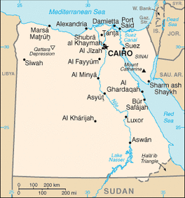
Picture from Map of Egypt
|
Ancient Egypts Natural Resources
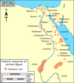
Picture from Ancient Egyptian Geography
|
Primary Source:
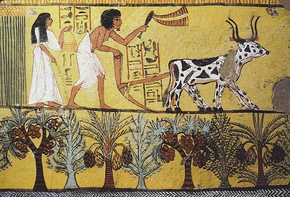
Picture from Dianabuja's blog
This is a painting of Senedjem and his wife preparing fields in the afterlife. The Nile made the land around it very fertile. Since the land was fertile many Egyptians farmed. In this painting it shows the use of animals when growing/harvesting crops. If the land wasn't fertile, not as many people would farm and Egyptians wouldn't feel the need to domesticate animals.
